New Research on Kingfish Movement in Eastern Australia
- News item
- Publication
Climate change has varied and sometimes unanticipated impacts on fisheries.
In southern Australian waters, a well document impact has been the movement of species southward. Anglers in southern parts of Australia are now able target species previously not found in the area, such as snapper and King George whiting.
Of these newly arrived species, one of the most popular is yellowtail kingfish.
Eastern Australian kingfish are now regularly caught off the coastlines of Victoria and Tasmania. But have you ever wondered how they get there? Or where they go when you’re not catching them?
New research published in the Canadian Journal of Fisheries and Aquatic Sciences explores these questions.
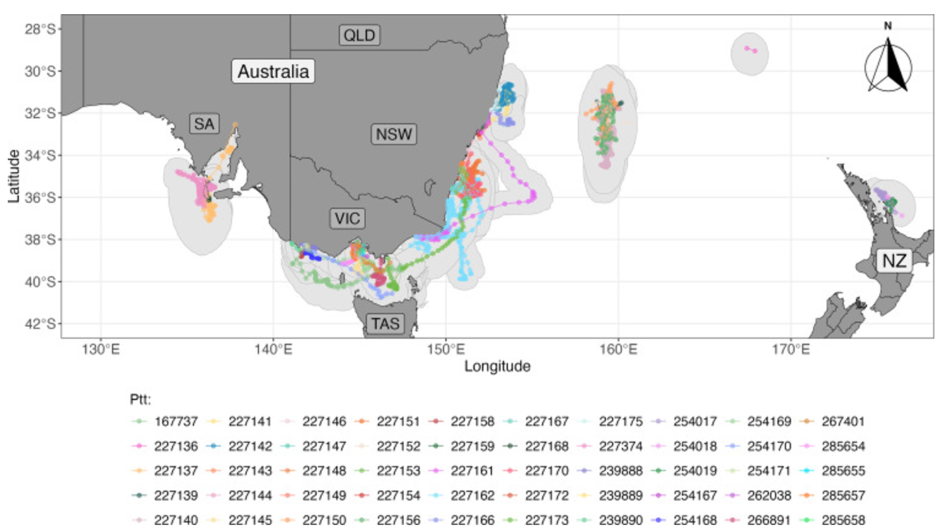
The research found that kingfish are highly mobile. They can move between New South Wales, Victoria and Tasmania and frequently transit between on-shelf and off-shelf waters, spending more time in offshore waters than previously thought. The tagged fish in the study moved on average 10.6 km per day, but one individual travelled over 4,000 km in 7 months. That’s a lot of swimming for one fish!
Kingfish spend most of their time in waters above 100 m but can dive up to 475 m. Their movements were closely correlated with water temperature. The study found that they retreat back to New South Wales in the wintertime. Whilst their ideal temperature is between 21 – 22ºC, they were observed in water temperatures as cool as 14ºC, and up to 25ºC.
Understanding where, how and when range extending species such as kingfish move is critical for fisheries management. The populations of kingfish are highly connected around south eastern Australia. Collaborative approaches to fisheries management which account for range shifts due to climate change, as well as the distribution of the species across several management jurisdictions are critical for sustainable management of the resource.
Read the full article here.
Do you have any observations about kingfish you’d like to share? We want to hear from you! post it in the Share your Knowledge section of the sea Change Australia website.
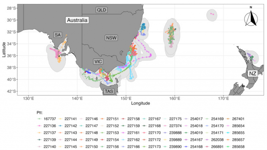
Figure (From Goddard et al, 2026) Most-likely tracks for kingfish tagged in this study (n = 50), providing an overall indication of spatial connectivity. Tracks are coloured by fish or PSAT ID (Ptt), and the 95% confidence interval polygons (light grey) denote the geolocation uncertainty for each track. Base maps were produced using the rnaturalearth package in R. Spatial projects were in EPSG 4326.